UN
8 Anthonys Way
£ 600,000
Description
We don't have a Description for this property.
- Bedrooms
- 4
- Bathrooms
- 0
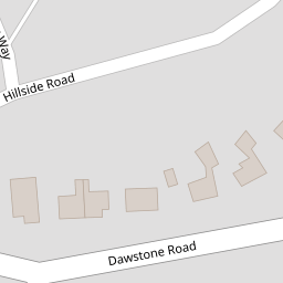

Leaflet © OpenStreetMap contributors
The heatmap indicates the level of crime in the area. The color of the heatmap indicates the crime severity and recency.
Metrics Year-on-Year
- Average area value
- 614,428.00 £Increased by 5.11 %
- Average area rental value
- 1,569.00 £/moIncreased by 44.21 %
- Est rental Yield
- 3.06 %Increased by 37.22 %
- Crime Rate
- 7.00 %Unchanged by 0.00 %
from 584,545.00 £
from 1,088.00 £/mo
from 2.23 %
from 7.00 %
Nearby Schools
| Name | Type | Ofsted | Distance |
|---|---|---|---|
| Gayton Primary School | Community School | Good | 0.46 KM |
| Heswall St Peter'S Cofe Primary School | Voluntary Aided School | Good | 1.00 KM |
| Heswall Primary School | Community School | Good | 1.27 KM |
| Barnston Primary School | Community School | Good | 1.92 KM |
| Stanley School | Community Special School | Good | 2.14 KM |
Images
Nearby Streets
| Name | Average Price | Average Sqft | Distance |
|---|---|---|---|
| Telegraph Road | £ 106,950 | 0 | 0.00 KM |
| Brow Lane | £ 1,200,000 | 0 | 0.00 KM |
| Meadway | £ 600,000 | 0 | 0.00 KM |
| Hill Top Lane | £ 0 | 0 | 0.00 KM |
| Old Mill Close | £ 0 | 0 | 0.00 KM |
Nearby Transport
| Name | NLC | TLC | Distance |
|---|---|---|---|
| Heswall | 2138 | HSW | 2.39 KM |
| Neston | 2139 | NES | 4.80 KM |
| Upton (Merseyside) | 2141 | UPT | 7.22 KM |
| Flint | 2513 | FLN | 9.17 KM |
| Leasowe | 2237 | LSW | 9.56 KM |
Nearby Listings
| Address | Price | Type | Score | Distance |
|---|---|---|---|---|
| Anthonys Way, Heswall, Wirral, CH60 | £ 1,100,000 | BUY | 7 / 10 | 0.01 KM |
| Anthonys Way, Lower Heswall, Wirral | £ 1,195,000 | BUY | 8 / 10 | 0.01 KM |
| Hillside Road, Heswall, Wirral, CH60 | £ 375,000 | BUY | 7 / 10 | 0.19 KM |
| South Drive, Heswall, Wirral | £ 399,950 | BUY | 7 / 10 | 0.22 KM |
| South Drive, Heswall, Wirral | £ 400,000 | BUY | Unknown | 0.24 KM |
Nearby Properties
| Address | Price | Distance |
|---|---|---|
| 8 Anthonys Way | £ 600,000 | 0.00 KM |
| 3 Moorland Close | £ 535,000 | 0.07 KM |
| 51 Hillside Road | £ 382,500 | 0.17 KM |
| 47 Hillside Road | £ 235,000 | 0.17 KM |
| 43 Hillside Road | £ 375,000 | 0.17 KM |